GeoCoordinate class is used to store and operate with geodetic coordinates. More...
#include "geo-coordinate.h"
Public Types | |
| enum | ReferenceEllipsoid_t { SPHERE , WGS84 , GRS80 } |
Public Member Functions | |
| GeoCoordinate () | |
| Create GeoCoordinate with zero values of longitude, latitude and altitude. More... | |
| GeoCoordinate (double latitude, double longitude, double altitude, bool correctIfInvalid=false) | |
| Create GeoCoordinate from given latitude, longitude and altitude decimal degree values. More... | |
| GeoCoordinate (double latitude, double longitude, double altitude, ReferenceEllipsoid_t refEllipsoid, bool correctIfInvalid=false) | |
| Create GeoCoordinate from given latitude, longitude and altitude decimal degree values. More... | |
| GeoCoordinate (Vector vector) | |
| Create GeoCoordinate from given vector (x, y, z). More... | |
| GeoCoordinate (Vector vector, ReferenceEllipsoid_t refEllipsoid) | |
| Create GeoCoordinate from given vector (x, y, z) and reference ellipsoid. More... | |
| double | GetAltitude () const |
| Gets altitude value of coordinate. More... | |
| double | GetLatitude () const |
| Gets latitude value of coordinate. More... | |
| double | GetLongitude () const |
| Gets longitude value of coordinate. More... | |
| ReferenceEllipsoid_t | GetRefEllipsoid () |
| Gets reference ellipsoid used by GeoCoordinate object. More... | |
| void | SetAltitude (double altitude) |
| Sets altitude value of coordinate. More... | |
| void | SetLatitude (double latitude) |
| Sets latitude value of coordinate. More... | |
| void | SetLongitude (double longitude) |
| Sets longitude value of coordinate. More... | |
| Vector | ToVector () const |
| Converts Geodetic coordinates to Cartesian coordinates. More... | |
Static Public Attributes | |
| static constexpr double | equatorRadius = 6378137.0 |
| static constexpr double | polarRadius_grs80 = 6356752.314103 |
| static constexpr double | polarRadius_sphere = 6378137.0 |
| static constexpr double | polarRadius_wgs84 = 6356752.314245 |
Private Member Functions | |
| void | Construct (double latitude, double longitude, double altitude, bool correctIfInvalid) |
| void | ConstructFromVector (const Vector &vector) |
| Creates Geodetic coordinates from given Cartesian coordinates. More... | |
| double | GetRadiusCurvature (double latitude) const |
| Gets the radius of curvature in the prime vertical. More... | |
| void | Initialize () |
| This method is called to initialize needed parameters according to used reference ellipsoide. More... | |
Static Private Member Functions | |
| static bool | IsValidAltitude (double altitude, ReferenceEllipsoid_t refEllipsoide) |
| Checks if altitude is in valid range. More... | |
| static bool | IsValidLatitude (double latitude) |
| Checks if latitude is in valid range. More... | |
| static bool | IsValidLongitude (double longitude) |
| Checks if longitude is in valid range. More... | |
Private Attributes | |
| double | m_altitude |
| altitude of coordinate More... | |
| double | m_e2Param |
| double | m_equatorRadius |
| double | m_latitude |
| latitude of coordinate More... | |
| double | m_longitude |
| longitude of coordinate More... | |
| double | m_polarRadius |
| ReferenceEllipsoid_t | m_refEllipsoid |
Detailed Description
GeoCoordinate class is used to store and operate with geodetic coordinates.
Latitude is in the degree range (-90, 90) with negative values -> south Longitude is in the degree range (-180, 180) with negative values -> west Altitude is in meters.
Definition at line 41 of file geo-coordinate.h.
Member Enumeration Documentation
◆ ReferenceEllipsoid_t
| Enumerator | |
|---|---|
| SPHERE | |
| WGS84 | |
| GRS80 | |
Definition at line 44 of file geo-coordinate.h.
Constructor & Destructor Documentation
◆ GeoCoordinate() [1/5]
| ns3::GeoCoordinate::GeoCoordinate | ( | double | latitude, |
| double | longitude, | ||
| double | altitude, | ||
| bool | correctIfInvalid = false |
||
| ) |
Create GeoCoordinate from given latitude, longitude and altitude decimal degree values.
Reference ellipsoid to be used is sphere.
- Parameters
-
latitude latitude of position, -90 ... 90 degrees longitude longitude of position, -180 ... 180 degrees altitude altitude of position, >= -EARTH_RADIUS correctIfInvalid Correct latitude and longitude if outside bounds
Definition at line 54 of file geo-coordinate.cc.
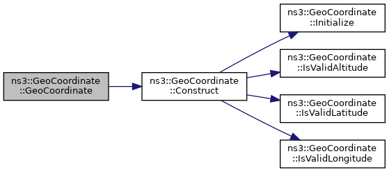
References Construct().
 Here is the call graph for this function:
◆ GeoCoordinate() [2/5]
| ns3::GeoCoordinate::GeoCoordinate | ( | double | latitude, |
| double | longitude, | ||
| double | altitude, | ||
| ReferenceEllipsoid_t | refEllipsoid, | ||
| bool | correctIfInvalid = false |
||
| ) |
Create GeoCoordinate from given latitude, longitude and altitude decimal degree values.
- Parameters
-
latitude latitude of position, -90 ... 90 degrees longitude longitude of position, -180 ... 180 degrees altitude altitude of position, >= -EARTH_RADIUS refEllipsoid Reference ellipsoid to be used correctIfInvalid Correct latitude and longitude if outside bounds
Definition at line 42 of file geo-coordinate.cc.
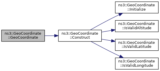
References Construct().
 Here is the call graph for this function:
◆ GeoCoordinate() [3/5]
| ns3::GeoCoordinate::GeoCoordinate | ( | Vector | vector | ) |
Create GeoCoordinate from given vector (x, y, z).
Reference ellipsoid to be used is sphere.
- Parameters
-
vector coordinates as Vector (x, y, z) (Cartesian)
Definition at line 65 of file geo-coordinate.cc.
References ConstructFromVector().
 Here is the call graph for this function:
◆ GeoCoordinate() [4/5]
| ns3::GeoCoordinate::GeoCoordinate | ( | Vector | vector, |
| ReferenceEllipsoid_t | refEllipsoid | ||
| ) |
Create GeoCoordinate from given vector (x, y, z) and reference ellipsoid.
- Parameters
-
vector coordinates as Vector (x, y, z) (Cartesian) refEllipsoid Reference ellipsoid to be used
Definition at line 73 of file geo-coordinate.cc.
References ConstructFromVector().
 Here is the call graph for this function:
◆ GeoCoordinate() [5/5]
| ns3::GeoCoordinate::GeoCoordinate | ( | ) |
Create GeoCoordinate with zero values of longitude, latitude and altitude.
Reference ellipsoid to be used is sphere.
Definition at line 81 of file geo-coordinate.cc.
References Initialize().
 Here is the call graph for this function:
Member Function Documentation
◆ Construct()
|
private |
- Parameters
-
latitude latitude of position longitude longitude of position altitude altitude of position correctIfInvalid Correct latitude and longitude if outside bounds
Helper for constructor to create GeoCoordinate from given latitude, longitude and altitude decimal degree values.
Accepted values:
Latitude: -90 ... 90 degrees Longitude: -180 ... 180 degrees Altitude: >= -EARTH_RADIUS
Definition at line 93 of file geo-coordinate.cc.
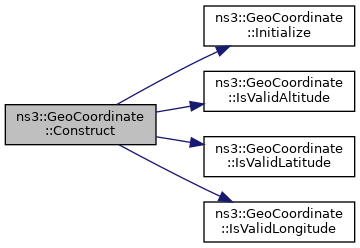
References Initialize(), IsValidAltitude(), IsValidLatitude(), IsValidLongitude(), m_altitude, m_latitude, m_longitude, and m_refEllipsoid.
Referenced by GeoCoordinate().
 Here is the call graph for this function:
 Here is the caller graph for this function:
◆ ConstructFromVector()
|
private |
Creates Geodetic coordinates from given Cartesian coordinates.
- Parameters
-
vector reference to vector containing Cartesian coordinates for creation.
Definition at line 250 of file geo-coordinate.cc.
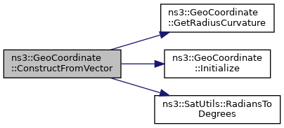
References GetRadiusCurvature(), Initialize(), m_altitude, m_e2Param, m_latitude, m_longitude, and ns3::SatUtils::RadiansToDegrees().
Referenced by GeoCoordinate().
 Here is the call graph for this function:
 Here is the caller graph for this function:
◆ GetAltitude()
| double ns3::GeoCoordinate::GetAltitude | ( | ) | const |
Gets altitude value of coordinate.
- Returns
- altitude
Definition at line 204 of file geo-coordinate.cc.
References m_altitude.
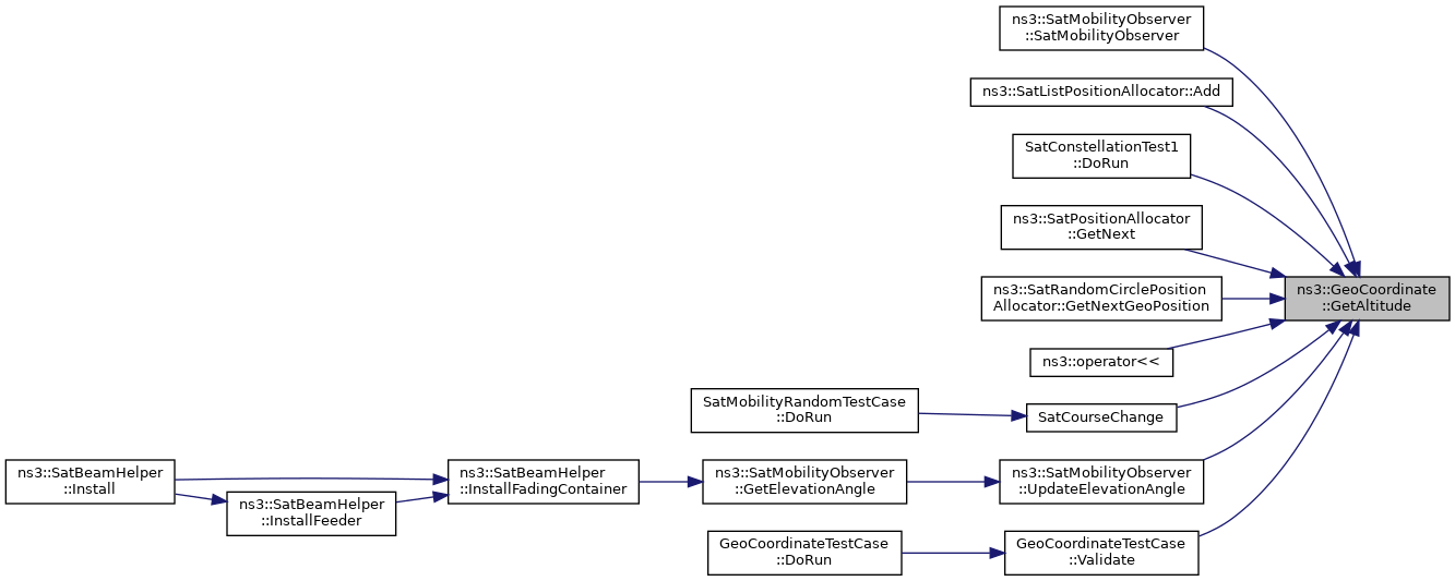
Referenced by ns3::SatMobilityObserver::SatMobilityObserver(), ns3::SatListPositionAllocator::Add(), SatConstellationTest1::DoRun(), ns3::SatPositionAllocator::GetNext(), ns3::SatRandomCirclePositionAllocator::GetNextGeoPosition(), ns3::operator<<(), SatCourseChange(), ns3::SatMobilityObserver::UpdateElevationAngle(), and GeoCoordinateTestCase::Validate().
 Here is the caller graph for this function:
◆ GetLatitude()
| double ns3::GeoCoordinate::GetLatitude | ( | ) | const |
Gets latitude value of coordinate.
- Returns
- latitude
Definition at line 197 of file geo-coordinate.cc.
References m_latitude.
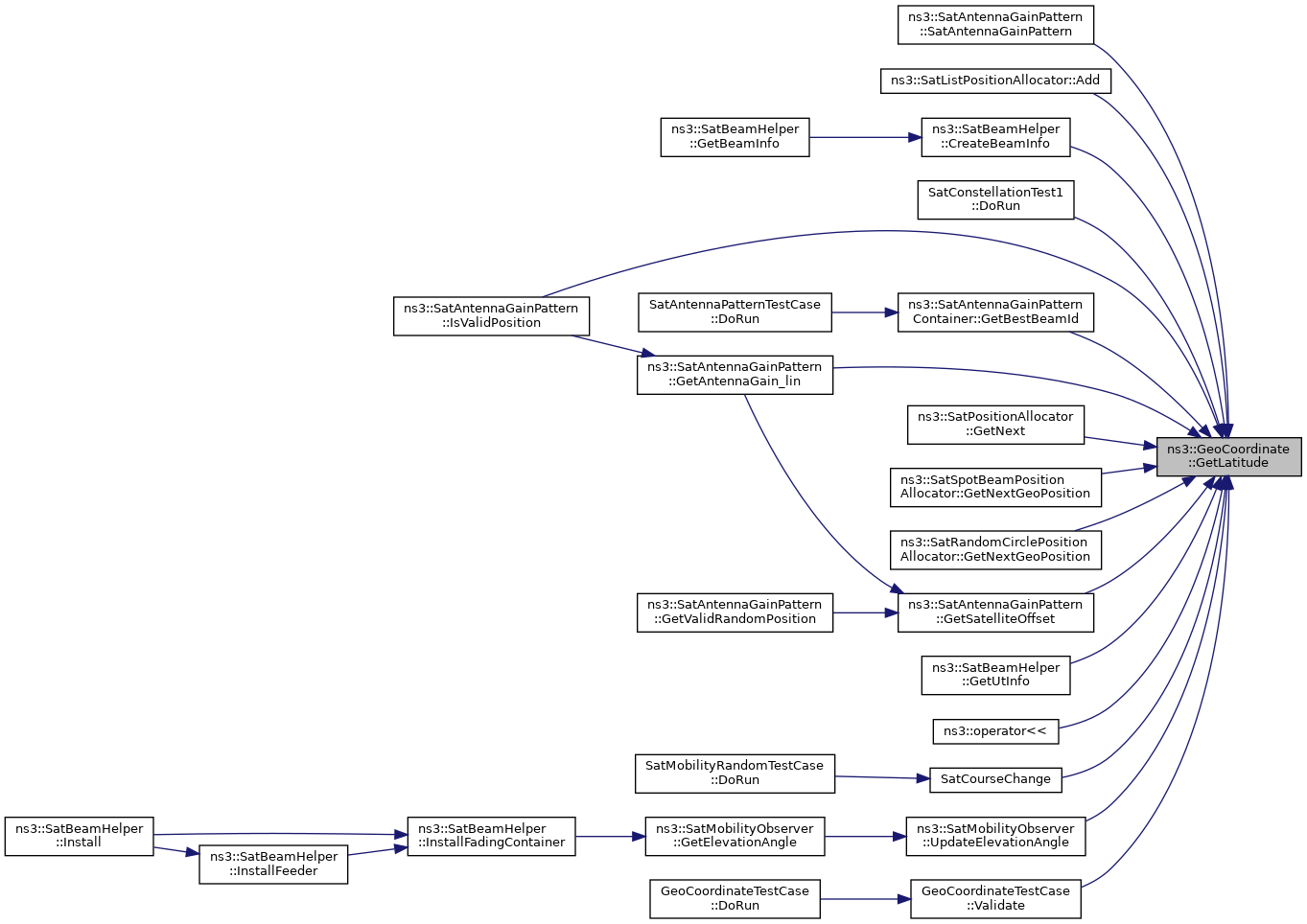
Referenced by ns3::SatAntennaGainPattern::SatAntennaGainPattern(), ns3::SatListPositionAllocator::Add(), ns3::SatBeamHelper::CreateBeamInfo(), SatConstellationTest1::DoRun(), ns3::SatAntennaGainPattern::GetAntennaGain_lin(), ns3::SatAntennaGainPatternContainer::GetBeamGain(), ns3::SatAntennaGainPatternContainer::GetBestBeamId(), ns3::SatAntennaGainPattern::GetCenterLatitude(), ns3::SatPositionAllocator::GetNext(), ns3::SatSpotBeamPositionAllocator::GetNextGeoPosition(), ns3::SatRandomCirclePositionAllocator::GetNextGeoPosition(), ns3::SatAntennaGainPattern::GetSatelliteOffset(), ns3::SatBeamHelper::GetUtInfo(), ns3::SatAntennaGainPattern::IsValidPosition(), ns3::operator<<(), SatCourseChange(), ns3::SatMobilityObserver::UpdateElevationAngle(), and GeoCoordinateTestCase::Validate().
 Here is the caller graph for this function:
◆ GetLongitude()
| double ns3::GeoCoordinate::GetLongitude | ( | ) | const |
Gets longitude value of coordinate.
- Returns
- longitude
Definition at line 190 of file geo-coordinate.cc.
References m_longitude.
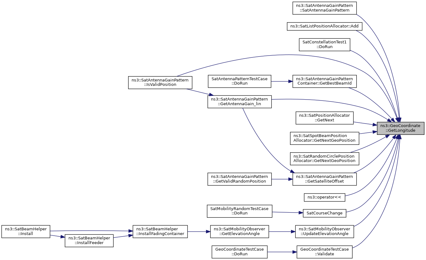
Referenced by ns3::SatAntennaGainPattern::SatAntennaGainPattern(), ns3::SatListPositionAllocator::Add(), SatConstellationTest1::DoRun(), ns3::SatAntennaGainPattern::GetAntennaGain_lin(), ns3::SatAntennaGainPatternContainer::GetBeamGain(), ns3::SatAntennaGainPatternContainer::GetBestBeamId(), ns3::SatAntennaGainPattern::GetCenterLongitude(), ns3::SatPositionAllocator::GetNext(), ns3::SatSpotBeamPositionAllocator::GetNextGeoPosition(), ns3::SatRandomCirclePositionAllocator::GetNextGeoPosition(), ns3::SatAntennaGainPattern::GetSatelliteOffset(), ns3::SatAntennaGainPattern::IsValidPosition(), ns3::operator<<(), SatCourseChange(), ns3::SatMobilityObserver::UpdateElevationAngle(), and GeoCoordinateTestCase::Validate().
 Here is the caller graph for this function:
◆ GetRadiusCurvature()
|
private |
Gets the radius of curvature in the prime vertical.
- Parameters
-
latitude latitude in radians at to get the radius of curvature.
- Returns
- value of the radius of curvature (meters)
Definition at line 316 of file geo-coordinate.cc.
References m_e2Param, and m_equatorRadius.
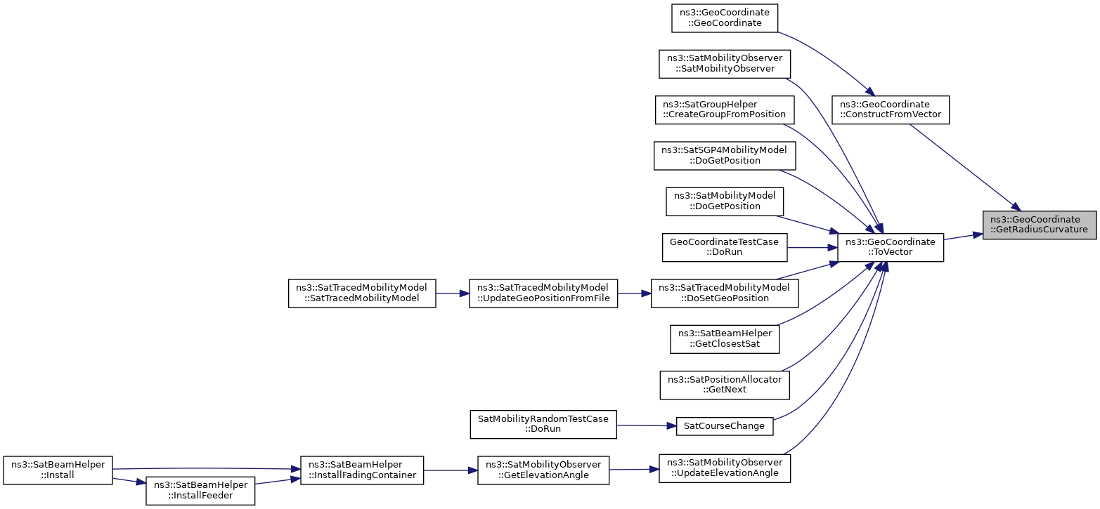
Referenced by ConstructFromVector(), and ToVector().
 Here is the caller graph for this function:
◆ GetRefEllipsoid()
|
inline |
Gets reference ellipsoid used by GeoCoordinate object.
- Returns
- reference ellipsoid.
Definition at line 106 of file geo-coordinate.h.
References m_refEllipsoid.
Referenced by ns3::SatMobilityObserver::SatMobilityObserver().
 Here is the caller graph for this function:
◆ Initialize()
|
private |
This method is called to initialize needed parameters according to used reference ellipsoide.
Definition at line 161 of file geo-coordinate.cc.
References equatorRadius, GRS80, m_e2Param, m_equatorRadius, m_polarRadius, m_refEllipsoid, polarRadius_grs80, polarRadius_sphere, polarRadius_wgs84, SPHERE, and WGS84.
Referenced by GeoCoordinate(), Construct(), and ConstructFromVector().
 Here is the caller graph for this function:
◆ IsValidAltitude()
|
inlinestaticprivate |
Checks if altitude is in valid range.
- Parameters
-
altitude to check
- Returns
- bool true altitude valid, false invalid.
Definition at line 322 of file geo-coordinate.cc.
References GRS80, polarRadius_grs80, polarRadius_sphere, polarRadius_wgs84, SPHERE, and WGS84.
Referenced by Construct(), and SetAltitude().
 Here is the caller graph for this function:
◆ IsValidLatitude()
|
inlinestaticprivate |
Checks if latitude is in valid range.
- Parameters
-
latitude to check
- Returns
- bool true latitude valid, false invalid
Definition at line 189 of file geo-coordinate.h.
Referenced by Construct(), and SetLatitude().
 Here is the caller graph for this function:
◆ IsValidLongitude()
|
inlinestaticprivate |
Checks if longitude is in valid range.
- Parameters
-
longitude to check
- Returns
- bool true longitude valid, false invalid
Definition at line 178 of file geo-coordinate.h.
Referenced by Construct(), and SetLongitude().
 Here is the caller graph for this function:
◆ SetAltitude()
| void ns3::GeoCoordinate::SetAltitude | ( | double | altitude | ) |
Sets altitude value of coordinate.
- Parameters
-
altitude longitude to set
Definition at line 237 of file geo-coordinate.cc.
References IsValidAltitude(), m_altitude, and m_refEllipsoid.
Referenced by SatMobilityObserverTestCase::DoRun(), ns3::SatSpotBeamPositionAllocator::GetNextGeoPosition(), ns3::operator>>(), and ns3::SatMobilityObserver::UpdateElevationAngle().
 Here is the call graph for this function:
 Here is the caller graph for this function:
◆ SetLatitude()
| void ns3::GeoCoordinate::SetLatitude | ( | double | latitude | ) |
Sets latitude value of coordinate.
- Parameters
-
latitude longitude to set
Definition at line 224 of file geo-coordinate.cc.
References IsValidLatitude(), and m_latitude.
Referenced by SatMobilityObserverTestCase::DoRun(), and ns3::operator>>().
 Here is the call graph for this function:
 Here is the caller graph for this function:
◆ SetLongitude()
| void ns3::GeoCoordinate::SetLongitude | ( | double | longitude | ) |
Sets longitude value of coordinate.
- Parameters
-
longitude longitude to set
Definition at line 211 of file geo-coordinate.cc.
References IsValidLongitude(), and m_longitude.
Referenced by SatMobilityObserverTestCase::DoRun(), and ns3::operator>>().
 Here is the call graph for this function:
 Here is the caller graph for this function:
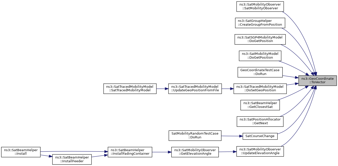
◆ ToVector()
| Vector ns3::GeoCoordinate::ToVector | ( | ) | const |
Converts Geodetic coordinates to Cartesian coordinates.
- Returns
- Vector containing Cartesian coordinates
Definition at line 143 of file geo-coordinate.cc.
References ns3::SatUtils::DegreesToRadians(), GetRadiusCurvature(), m_altitude, m_e2Param, m_latitude, and m_longitude.
Referenced by ns3::SatMobilityObserver::SatMobilityObserver(), ns3::SatGroupHelper::CreateGroupFromPosition(), ns3::SatSGP4MobilityModel::DoGetPosition(), ns3::SatMobilityModel::DoGetPosition(), GeoCoordinateTestCase::DoRun(), ns3::SatTracedMobilityModel::DoSetGeoPosition(), ns3::SatTopology::GetClosestSat(), ns3::SatMobilityModel::GetDistanceFrom(), ns3::SatPositionAllocator::GetNext(), SatCourseChange(), and ns3::SatMobilityObserver::UpdateElevationAngle().
 Here is the call graph for this function:
 Here is the caller graph for this function:
Member Data Documentation
◆ equatorRadius
|
staticconstexpr |
Definition at line 157 of file geo-coordinate.h.
Referenced by Initialize().
◆ m_altitude
|
private |
altitude of coordinate
Definition at line 244 of file geo-coordinate.h.
Referenced by Construct(), ConstructFromVector(), GetAltitude(), SetAltitude(), and ToVector().
◆ m_e2Param
|
private |
Definition at line 247 of file geo-coordinate.h.
Referenced by ConstructFromVector(), GetRadiusCurvature(), Initialize(), and ToVector().
◆ m_equatorRadius
|
private |
Definition at line 248 of file geo-coordinate.h.
Referenced by GetRadiusCurvature(), and Initialize().
◆ m_latitude
|
private |
latitude of coordinate
Definition at line 236 of file geo-coordinate.h.
Referenced by Construct(), ConstructFromVector(), GetLatitude(), SetLatitude(), and ToVector().
◆ m_longitude
|
private |
longitude of coordinate
Definition at line 240 of file geo-coordinate.h.
Referenced by Construct(), ConstructFromVector(), GetLongitude(), SetLongitude(), and ToVector().
◆ m_polarRadius
|
private |
Definition at line 249 of file geo-coordinate.h.
Referenced by Initialize().
◆ m_refEllipsoid
|
private |
Definition at line 246 of file geo-coordinate.h.
Referenced by Construct(), GetRefEllipsoid(), Initialize(), and SetAltitude().
◆ polarRadius_grs80
|
staticconstexpr |
Definition at line 162 of file geo-coordinate.h.
Referenced by Initialize(), and IsValidAltitude().
◆ polarRadius_sphere
|
staticconstexpr |
Definition at line 160 of file geo-coordinate.h.
Referenced by ns3::SatRandomCirclePositionAllocator::GetNextGeoPosition(), Initialize(), and IsValidAltitude().
◆ polarRadius_wgs84
|
staticconstexpr |
Definition at line 161 of file geo-coordinate.h.
Referenced by Initialize(), and IsValidAltitude().
The documentation for this class was generated from the following files:
- /builds/sns3/satellite/satellite/model/geo-coordinate.h
- /builds/sns3/satellite/satellite/model/geo-coordinate.cc
